Thinking about buying or selling near Rock Creek in Clinton? The creek can add weekend fishing, peaceful views and that signature Montana feel. It can also bring flood rules, easements and a few extra steps during due diligence. In this guide, you’ll learn how Rock Creek influences buyer demand, pricing, offer terms and what to verify before you list or write an offer. Let’s dive in.
Why Rock Creek matters to buyers
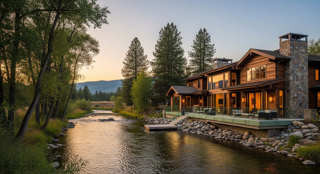
Rock Creek appeals to outdoor‑minded buyers who value access to trout fishing, wading and the sound of running water. In summer, snowmelt‑fed flows and cool shade create a real lifestyle draw. That pull shows up in showing activity and buyer enthusiasm when the parcel has safe, convenient creek access.
Buyers also respond to the aesthetics. Views, native vegetation and wildlife can make a home feel more private and grounded in nature. A riparian corridor often acts like a green buffer between neighbors, which many buyers appreciate.
Not every buyer wants a creek. Some worry about flood risk, maintenance and vegetation management. If a buyer prefers a low‑maintenance suburban yard, they may see streamside upkeep and wildfire‑wise landscaping as a drawback. That mix of reactions is why pricing and time on market can vary from parcel to parcel.
Who tends to pay a premium
- Lifestyle buyers prioritizing fishing and outdoor access.
- Second‑home buyers seeking quiet, scenic settings.
- Conservation‑minded buyers who value intact riparian habitat.
Well‑presented creekfront listings in Clinton typically get faster early interest, but they also attract more due diligence. Expect offers with added contingencies for inspections, insurance review and verification of flood and access details.
Pricing: what to expect
Across many markets, studies and industry observations show a positive “waterfront premium,” but the size varies by waterbody type, condition and risk. Compared with lakefront or major riverfront, small creek premiums in rural Montana are usually smaller and more variable because flows can be intermittent and boat access is limited.
In Clinton, the premium is best estimated using recent local sales where the main difference is creek adjacency. Because true creekfront comps are often scarce, the premium is usually a range, not a single number. In rural Montana creek settings, agents often see premiums in the low single digits to low double digits. Local MLS and assessor data are needed to pinpoint a realistic range for your specific parcel.
How offers and appraisals shift near the creek
- More contingencies: Buyers may ask for extended inspection windows and specific reports for soils, flood and erosion.
- Multiple offers are possible: When access is great and risk feels low, you may see escalation. Properties with obvious flood issues can see lower offers or require concessions.
- Appraisal variance: Limited creekfront comps can challenge financing. Sellers should prepare a clear market narrative and any relevant comps to help the appraiser.
Verify the parcel, not just the address
Several streams around Missoula share the Rock Creek name. First, confirm that the waterway described in a listing is the one on or next to the parcel, and identify its exact relationship to the property lines.
Map and survey the creek
Start with a current survey or recorded plat that shows the creek relative to boundaries. Use the Missoula County GIS parcel viewer to verify lines and any recorded setbacks or easements. Because some private easements do not display on GIS, order a title report early.
Confirm the channel type
Check if the creek reach is perennial or intermittent. Two parcels can have different buyer reactions and risk profiles based on flow reliability. A narrow mountain reach feels different from a broad floodplain, so note how confined the channel is and whether there’s room for floodwater to spread.
Evaluate elevation and slope
Elevation changes between the home and the creek matter. A higher bench above the water can reduce perceived flood risk and insurance needs compared to a low, flat area near the bank. Documenting these conditions can strengthen your pricing and negotiations.
Risks and constraints you should check
A creek can increase enjoyment and value, but it also brings rules and responsibilities that affect pricing, marketing and ownership.
Flood zones and insurance
Use the FEMA Flood Map Service Center to see if the parcel sits in a Special Flood Hazard Area. If it does and you use a federally backed loan, flood insurance is typically required. Even outside mapped zones, private carriers may price for elevated risk. Missoula County floodplain rules can affect where you build and whether elevation or mitigation is needed.
Public access expectations
Montana’s stream access principles allow certain public recreation up to the ordinary high‑water mark on qualifying streams. If a reach of Rock Creek near your parcel is subject to those rules, that can influence privacy and use. Confirm classifications and local practices with Montana Fish, Wildlife & Parks.
Water rights and ditches
Owning land next to a creek does not automatically grant the right to divert water. Montana follows prior appropriation. Verify any claimed irrigation or stock water with the DNRC water rights database, including point of diversion, priority date and ditch alignments that may cross the parcel.
Easements and encumbrances
Utility, ditch, conservation and public access easements can limit development and private use. A title report will show recorded easements. Do not rely on GIS alone for private easements. Knowing these early helps avoid renegotiations late in escrow.
Septic, wells and soils
Streamside soils and higher water tables affect where septic drainfields and wells can go. Check Missoula County environmental health records for septic and well permits and any required setbacks from the creek.
Bank stability and erosion
Active bank erosion can threaten structures and reduce usable area. If the bank shows signs of instability, plan for an engineer or geomorphology review. Sellers should disclose known flood, erosion or stabilization history.
Work and permits near the creek
Shoreline stabilization, in‑stream work and small private crossings often require permits. Expect to coordinate with Missoula County and state agencies, and sometimes the U.S. Army Corps, before you alter banks, vegetation or channels.
Steps for Clinton sellers
Prepare documents buyers want to see
- Current survey or plat showing the creek’s location.
- Title report with all recorded easements and encumbrances.
- FEMA flood map status and any flood insurance claim history.
- DNRC water right records or ditch agreements if you claim water use.
- Missoula County permits for buildings, floodplain work, septic and wells.
- Any past engineering or stabilization reports and conservation easements.
- Recent comparable sales, including clearly creek‑adjacent comps.
Price and present with context
Price the setting, access and usability, then adjust for any added insurance costs or constraints. Highlight safe access, functional outdoor spaces and documented risk mitigation. Provide data to appraisers, including a map packet and relevant comps, to reduce appraisal gaps.
Disclosures buyers expect
Be direct about flood events, erosion, easements and any restrictions. Clear disclosure builds trust and reduces retrade risk during inspections.
Steps for Clinton buyers
Run a focused due diligence plan
- Confirm the exact location and nature of the creek on the parcel.
- Check FEMA and Missoula County floodplain status and insurance needs.
- Order a title report to identify easements and encumbrances.
- Verify DNRC water rights if you plan irrigation or diversion.
- Review septic and well permits, and consider a soils feasibility report if you plan to expand.
- Inspect bank stability if structures sit near the creek or if erosion is visible.
Budget for ownership
Account for possible flood insurance, periodic bank or vegetation maintenance and any permit fees for shoreline work. If a conservation easement exists, make sure your long‑term plans fit the allowed uses.
Local data sources to consult
- Missoula County planning, floodplain, GIS and environmental health pages for zoning, setbacks, permits and parcel verification.
- FEMA Flood Map Service Center for flood zones and insurance rate maps.
- Montana DNRC for water rights records and permits.
- Montana Fish, Wildlife & Parks for stream access classifications and fisheries information.
- Regional MLS and the county assessor for creek‑adjacent comparable sales and days on market.
- Local insurance agents experienced with Missoula County water‑adjacent properties.
Work with a local land specialist
The single most important early steps are simple: verify the creek’s exact location relative to the parcel, check FEMA and county floodplain status and order a title report. From there, you can price opportunity and manage risk with confidence. If you want an advisor who understands both the lifestyle and the technical side of creekfront property in Clinton, partner with a Missoula‑based land specialist who can coordinate mapping, permits, comps and marketing from day one.
Ready to talk strategy for your Rock Creek property in Clinton? Reach out to Unknown Company to review your parcel, pull local comps and build a plan that fits your goals.
FAQs
How does Rock Creek affect Clinton home prices?
- Proximity to Rock Creek can increase buyer interest and support a price premium, but the size varies by access, risk and parcel specifics. Local comps are needed to estimate your range.
What due diligence is essential for a creekfront purchase in Clinton?
- Verify flood zones, order a title report for easements, check DNRC water rights, confirm septic and well permitting and review bank stability where structures sit near the creek.
Do I automatically get water rights if my land touches Rock Creek?
- No. Montana follows prior appropriation. You must verify any claimed rights with DNRC records, including priority date and point of diversion.
Will I need flood insurance on a Rock Creek property?
- If the home is in a FEMA Special Flood Hazard Area and you use a federally backed loan, flood insurance is typically required. Private carriers may price risk even outside mapped zones.
Can the public access Rock Creek behind my property?
- Some streams in Montana allow public recreation up to the ordinary high‑water mark. Confirm how the reach near your parcel is classified with Montana Fish, Wildlife & Parks.
What permits are required to work near the creek?
- Bank stabilization, in‑stream work and crossings often require county and state permits, and sometimes federal review. Always check Missoula County rules and state permitting before starting work.